
As networks get larger, offer more options and attract more users, it’s important to ensure that riders can quickly understand the areas and routes covered when planning their journeys.
To this end, we will now start showing bus stops and micro-mobility stations at wider zoom levels, where they were previously hidden.
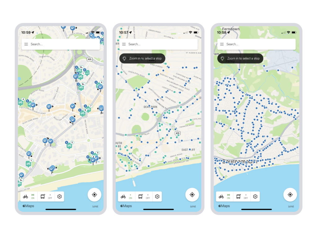
Bus stops will now be shown at all zoom levels, and at medium and wider zoom levels will be simplified into a smaller marker to ensure clarity and improve performance. Favourited stops will now also be shown at all zoom levels.
Micro-mobility stations will now be shown at medium zoom levels, again with a smaller marker, but will remain hidden at the widest zoom level.
This will ensure that as the rider zooms out they will continue to see the capabilities of the network for a visual association between their destinations and the network itself.
Live buses will continue to be shown in apps at medium zoom levels and below.
Additionally, we have made some improvements to the platform’s mapping architecture as follows:
- We have adjusted the colours of the map tiles on web to make them more distinctive and recognisable.
- We are now using Apple Maps as the mapping platform in the iOS app. Using the mapping platform provided by the operating system improves familiarity, performance and security. Android will continue to use Google Maps.
- We have made performance improvements across all platforms.
These changes will be made available in early January 2023.